
Become a supporter
Hello,
One of my hobby is to try to add undocumented charging points for electric bikes on openstreetmap. On this weekend trip I found one that was not displayed in cycle .travel. However when I wanted to add it to OSM, I realized there *is* something there:
it is right at the center of this map (circled in red on the screenshot:
https://www.openstreetmap.org/#map=19/47.581994/9.916875
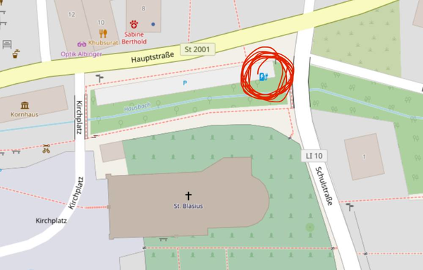
The one that works are documented as charging station with bicycle =
yes; motorcar = no; The one that don't show up is documented as "EV
charging point" (same tags). I dont see any good reason to chose one or
the other in OSM, therefore I don't feel like changing the type. Shall I
do it ?
Best, Cécile
I just noticed a strange bug on my todays's trip, which was going through a tunnel. On the web interface, the display is normal, but on the iphone it shows a horrible climb, that couls discourage people from taking the route (max 27 % !!!):
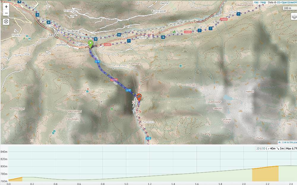
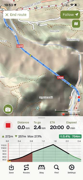
https://cycle.travel/map/journey/1052601
Best regards,
Cécile
Hello,
probably, this is a known issue, the journey always automatically start, even if deactivate this option in the preference. (I use an iPhone).
Romuald
Hello,
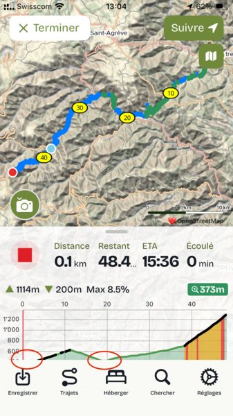
the lowest elevation of the profile of the journey is always cut, as if the vertical scale is not properly calculated. Example on the screenshot. I tried to reboot the iPhone and use the latest version of the app and iOS, but no change. It does not do that on the iPhone of my wife.
Best
Romuald
Hello,
We happily used cycle.travel for plannling and following a nice trip during easter. Werealized that there exist some bike charging stations, some documented properly on OSM, but to spot them on the map, on needs a very high zoom level, and carefully checking. For planning the tour, it would be great to be able to localize them in an overview of a 400 km trip. I didnt find any tool helping to do this. Thank you for your help!
Cécile


Made in the Cotswolds. Published by Éditions Système D Ltd.
Log in with your cycle.travel account:
| Password |
Or simply use your account on:
